If you're a member of the military service, you know how essential map reading and land navigation skills are. You rely on them for many of your missions or deployments, and without proper training in this field, you could find yourself in an environment you're not familiar with.
Learning how to read a map, understand navigation points and plan a course is key to success, yet can be difficult to comprehend at first. The good news is, with a few helpful tips and some practice, you can increase your navigational skills and have the knowledge and confidence you need to be prepared for any situation in the military.
In this blog post, we'll be discussing everything military members need to know about how to map read and land navigate. We'll be covering topics such as map symbols, geographical features, methods of terrain association, and more – so you can feel confident and in control when it comes to facing challenging terrain and conditions. So let's get started!
Quick Clarification
Navigation is a key skill for military personnel as it allows them to accurately ascertain their location, plan routes and understand tactical situations. Additionally, it helps ensure that operations are conducted safely and efficiently, helping protect personnel and improve mission success.
Introduction to Navigation in the Military
Navigation in the military is a key component of successful missions. Clearly understanding and accurately following navigational paths can be the difference between life and death, victory and defeat. To set their troops up for success, military personnel need to understand basic navigation principles and possess the necessary skills to operate in any terrain or weather condition.
Before diving into mapping and land navigating tactics, it is important to understand the goal of navigation. Navigation cuts down on time spent travelling from one point to another. It enables troops to traverse terrain with fewer mistakes, fewer detours and greater safety. Failure to adequately navigate can result in disorientation, delays, or worse. For example, a failure to correctly use locating markers such as landmarks or surveillance systems can lead to lower morale, emotional distress or even casualties if hostile forces are encountered.
Basic navigation requires a few key elements: accuracy of location; knowledge pertaining to reading directions; clear communication with fellow travelers; situational awareness; and having reliable resources such as maps available at all times. Accurate location means understanding the coordinates of where you are currently located using longitude and latitude data. Directions used by the military typically consist of four cardinal points: North, South, East and West (N/S/E/W). Knowing which direction is being followed is part of situational awareness that should also include maintaining an overview of potential hazards such as environmental risks like flooding or treacherous terrain or human-made threats like missiles fired from hostile forces. Finally, relying on reliable resources like maps or GPS makes sure that routes are planned as accurately as possible with relevant points of interests factored in along the way.
Having a comprehensive understanding of navigation is essential before doing any mapping or land navigating in the military. Fortunately, technology advancements have greatly improved navigational capabilities allowing detailed records that can be easily accessed when needed most. Understanding these basics will set soldiers up for success and will prepare them for what comes next – mastering the fundamentals of map reading and land navigating that will be discussed in the next section.
Understanding the Basics of Navigation
Navigating is the skill of possessing a sense of direction while traveling, and understanding one's current position and desired destination. To be able to correctly use a map, compass and other navigation tools, such as GPS or survey instruments, it is important to understand the basics of navigation.
Navigation involves plotting a course and determining coordinates to get from point A to point B. As movements in navigation are made through physical space, it is important to understand the basic skills of navigation before applying them. The most important things in navigation are planning, accuracy and being able to assess risks along the route. Map reading requires knowing how to interpret different geographic features on a map and what direction the traveler needs to go in order to reach their destination. Knowing how to plot coordinates on the map is also required so that landmarks can be located accurately. Once plotted, landmarks can be used for orientation in relation to an known fixed points such as roads, rivers or mountains.
In addition, at its most basic level navigation includes interpreting location by understanding terrain, weather conditions and climate variables. By understanding these basics environmental points within the landscape it is possible for travelers using navigational tools to estimate how long it will take for them to reach a destination, allowing for informed decisions about alternate routes if necessary.
For military personnel coordinating large operations over extended periods of time it is vital that they have a comprehensive knowledge of navigation so they are equipped with the skills needed to plan their journey efficiently while dealing with any unexpected challenges along they way.
To sum up, understanding the basics of navigation requires knowledge of features on a map and landmass as well as accurate readings from navigational tools such as compasses and GPS units. With this knowledge military personnel will be able better plan and execute objectives with detailed details regarding open-ended missions or short-term operations. In the next section we will cover major types of navigation used by the military.
- A 2018 study found that navigation accuracy is essential to mission success in the military.
- The National Geospatial Agency estimates that U.S. warfighters rely on over 500 different navigational and geospatial products, many of which are vital for missions.
- According to the U.S. Army Combat Capabilities Development Command, navigation is vital to mission success in military operations due to uncertain terrain, unpredictable weather conditions, and GPS jamming [1] by adversaries.
Wearable GPS units increasingly used
As a soldier on the battlefield, I can attest to the critical importance of modern smartwatches with GPS technology. These devices provide us with an unprecedented level of situational awareness that we simply did not have in the past, even if their use isn't particularly encouraged.
With GPS tracking on my watch, I can monitor my movements as well as those of my fellow troops, giving us all an accurate picture of our positions and the location of our allies. This information is essential for making quick, informed decisions in the heat of battle, and it can be shared quickly and easily with the rest of the team. Additionally, modern smartwatches are built to last, and they can withstand the harsh conditions of military operations. As a result, I rely on my smartwatch every day to stay informed, connected, and ready for whatever challenges come our way.
Major Types of Navigation Used by the Military
Navigation plays a crucial role in the military and is essential for successful mission completion. There are three major navigation methods used by the military: visual navigation, global positioning systems (GPS), and dead reckoning.
Visual navigation takes place by directly viewing and recognizing landmarks, terrain features, or points on the map to calculate progress and plot a course of action. Visual navigation is often praised as an intuitive way of navigating and beneficial when GPS signals are disrupted. Despite having no technology constraints, visual navigation can be difficult due to lacking daylight or visibility. Political boundaries, natural features, man-made objects, waterways, roads, trails, and terrain features all become friendly if they are used correctly in visual navigation tactics.
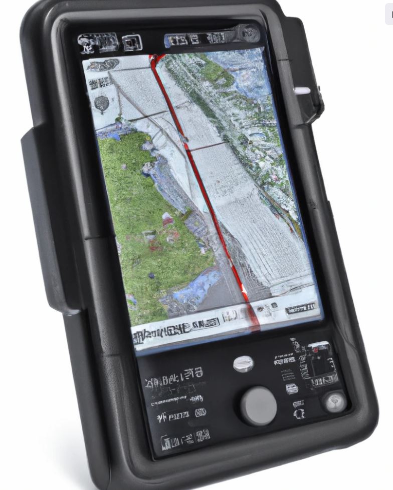
GPS navigation has become a core part of modern military operations. GPS technology has revolutionized the way armed forces conduct operations and receive information in real time at any location globally. GPS provides more exact positioning than traditional methods due to its ability to measure three-dimensional distances accurately and rapidly determine positions on land or sea with pinpoint precision. Soldiers commonly rely on multiple sources for positional data such as geodetic survey control points and known locations from reconnaissance missions that help compliment GPS’s accuracy. Due to the dependent nature of GPS on connectivity, some may not favor this method as compared to other traditional methods because of the increased risks associated with satellite jamming or foraging for fuel which can lead to GPS signals weakening or temporarily disappearing altogether.
Dead reckoning is another type of navigational method widely used by the military that involves using velocity vectors relative to time intervals or measuring direction change at each set interval in order to predict position at given times while navigating. Even though dead reckoning can provide critical information while conducting operations without dependable visual references, it is limited by its inherent reliance on accurate measurements of speed and direction changes combined with reliable meteorological data which can be unreliable under certain circumstances; rendering a final fix inaccurate after much navigating effort devoted towards one objective point.
The various types of navigation techniques used by the military have allowed them to complete successful missions despite challenging circumstances levied upon them during their operations either through environmental factors or technological challenges posed by adversaries.
It is these different methods of navigational tactics that allow members of our armed forces an opportunity to find their way regardless of external challenges they may face during their journey.
Next, we will take a deeper look into how map reading skills paired with use of coordinates give soldiers an edge when it comes to navigating complicated terrain during their missions throughout the world.
Most Important Highlights
Navigation is an essential skill in the military, and can be achieved through three different methods: visual navigation, global positioning systems, and dead reckoning. Visual navigation is intuitive but risks visibility issues; GPS navigation provides accurate readings, but is dependent upon reliable connections; and dead reckoning is accurate but limited by depending upon accurate measurements of speed and direction. Map reading skills coupled with coordinates give soldiers an edge when navigating complex terrain for their missions.
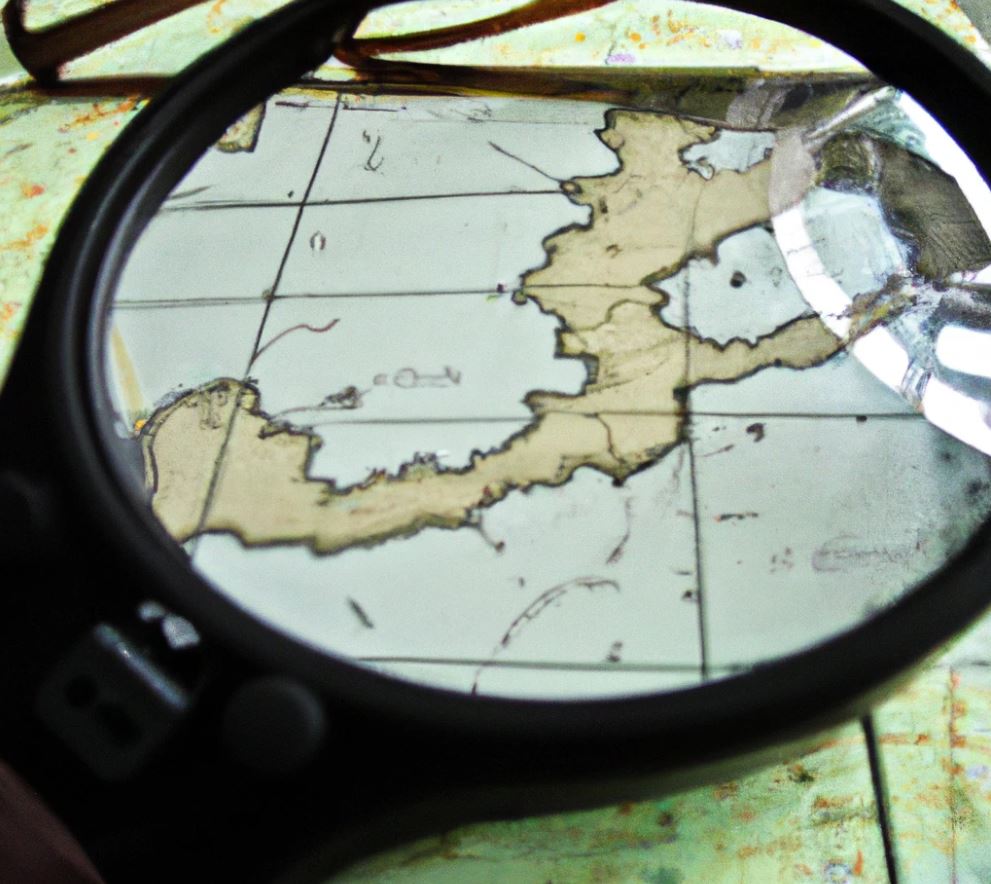
Map Reading and Use of Coordinates
Map reading and the use of coordinates are essential skills for navigating unfamiliar terrain. While traditional methods such as understanding land features and following paths may be used as well, coordinates are a precise way to pinpoint locations reliably. By having an understanding of coordinate systems, map readers can access a route to their destination more easily, reducing the likelihood of getting lost.
Using coordinates can be incredibly helpful when navigating ever-changing terrain. When using paper maps, the grid system allows readers to accurately record positions and match up their location on map with the physical area they are traveling through. Additionally, modern tools such as GPS allow individuals to locate themselves in seconds by entering coordinates into a device. With such technologies available, navigating with coordinates can reduce the amount of time it takes to reach a specific site among military personnel.
Though map reading and using coordinates may appear simple, some find it difficult due to its detail-oriented nature. Furthermore, with new technology often comes glitches or technical issues that can impede navigation when relying heavily on digital devices. As such, military personnel may find the traditional methods of map reading preferable for efficiency and reliability reasons when travelling off-road in varying climates and extremity levels.
Regardless of abilities or preferences, having an understanding of both coordinate systems and traditional methods used for map reading is highly beneficial for navigating terrain successfully. This allows individuals to have an alternate plan if one navigational tactic fails or becomes unsuitable for certain environments. It’s important to note that even with a working knowledge of coordinate systems, having an awareness of your local geography is beneficial for any situation that may arise while traveling in unfamiliar areas.
By having the right tools at hand and honing your map reading and navigation skills, military personnel will be prepared to take on any challenge they may face while lost in unfamiliar territory. The next section outlines key pieces of equipment needed for successful navigation along any journey undertaken.
To further prepare for navigation tasks ahead, the following section outlines important tools needed for success: "Important Tools of Navigation".
Resection Overview
Here are the actionable steps to use the Resection method to determine one's position on a map:
- Orient the map using a compass.
- Identify two or three well-defined locations on the ground that can be pinpointed on the map.
- Measure the magnetic azimuth from your location to one of the known positions on the ground using a compass.
- Convert the magnetic azimuth to a grid azimuth using a conversion chart or formula.
- Determine the back azimuth by adding or subtracting 180 degrees to or from the grid azimuth, depending on whether the azimuth is more or less than 180 degrees.
- Using a protractor, draw a line for the back azimuth on the map from the known position back toward your unknown position.
- Repeat steps 3 to 6 for a second and third known position, if desired.
- The intersection of the lines on the map is your current location.
- Determine the grid coordinates of your location to the desired accuracy.
Important Tools of Navigation
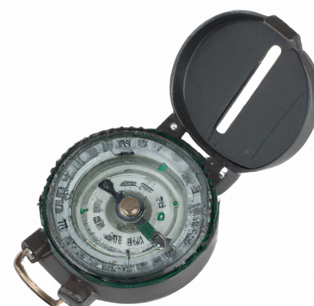
Navigating the military requires many important tools. It can be easy to get lost in a foreign land, so it is crucial to have the right skills and equipment to help guide through any territory. Common tools used in navigation are maps, compasses, and GPS systems. While these tools may seem basic, they offer a level of assurance that one will find their way back without issue.
Maps provide a visual representation of terrain on which navigators can take stock of their position in relation to the area. Such maps can show diverse kinds of information about an area, from types of terrain guiding potential routes and topographical details to landmarks conveying signs for direction. These visual representations are incredibly useful towards orienting a navigator if they don’t know the direct route back or how to reach a destination quickly.
Compasses act more like advisors than navigational tools by informing a user on the direction they are facing and providing options in terms of headings they could take next. This device helps eliminate uncertainties of direction and aids in finding bearings quickly, thus allowing for efficient navigation between points and minimizing time taken away from one’s task.
GPS systems rely heavily on satellites orbiting Earth rather than physical features on land. By tracking signals these satellites transmit, Global Positioning System devices allow users to pinpoint their exact location as well as figure out possible routes outside established paths — such as that between two mountains — should difficulties arise during travel. In addition, GPS systems sometimes provide vital information about potential dangers along the way or other important details related to a mission or task at hand that one might not be aware of beforehand.
Ultimately, all three tools perform different functions but all work together towards the same purpose: getting from point A to point B with greater accuracy and safety than would otherwise be possible without them. By using maps, compasses, and GPS systems in tandem with each other and observing everything that is transpiring at every moment during navigation tasks —weather patterns, terrain characteristics, etc.—one can maximize their efficiency and effectiveness on the job.
With this understanding in place, it is now time to discuss how these individual navigation tools —maps compasses, and GPS systems—work together within military operations. The following section will discuss these key elements separately before examining their collective value when combined with one another. Introducing our next section: "Maps, Compasses and GPS Systems".
GPS, GLONASS and Galileo satellite navigation
The Global Positioning System (GPS), GLONASS and Galileo satellite navigation systems provide accurate and reliable location data to military personnel and are crucial in mission success operations. The accuracy of GPS is especially beneficial for military missions, as with this information, troops can accurately measure their distances traveled and receive exact coordinates of their location, making them less vulnerable to surprise attacks.
The GLONASS global navigation system was created by the Russian government in the 1990s as a rival to GPS, and its signals are comparable to those of GPS. GLONASS covers more areas than GPS but it isn't used as widely as large parts of the world do not have access to the necessary receiving hardware.
Galileo is also a Global Navigation Satellite System, which uses an array of Satellites orbiting planet Earth.This is based on GPS technology but received faster frequency signals that gives greater accuracy at no extra cost. Although Galileo is still in its development phase, it has already been adopted by some defense systems, providing yet another reliable layer for military navigation.
This high-quality, timely positioning data provided by the three major satellite navigation systems enables soldiers to successfully complete their operations. At the same time, there are issues arising from reliance on satellite-based solutions: if signals from any of these navigational systems were interfered with or hijacked by adversaries, military missions could be put in danger. Therefore sharing information on how different navigational technologies work and exploring countermeasures for potential hacks could help protect against such malicious intent.
With GPS, GLONASS and Galileo satellite navigation providing critically important real-time positioning data for the successful completion of military operations, the next section will discuss navigating in different environments and how this must be taken into account when using these navigational methods.
Navigating in Different Environments
Navigating in different environments can be challenging, particularly when the terrain is unfamiliar. Depending on the environment and how familiar a navigator is with it, there are various techniques to employ for successful navigation.
One strategy is to use referential or observational landmarks as a primary means of orientation. This typically means searching the immediate area for physical objects or plants which can provide clues and help to navigate, such as rock formations, hills, and trails. Another strategy is to use cardinal directions (North, South, East, West) in order to establish a more general direction of travel and use geographic features like rivers and roads for guidance.
There are arguments for using both techniques in different scenarios; being mindful of local conditions such as changes in daylight hours and weather will also affect navigational decisions. If a navigator has ample time and good visibility, they may have more success employing observational techniques such as reading physical features or vegetation. On the other hand, if they need to traverse an area quickly or visibility is poor due to weather conditions or night travel, cardinal direction navigating by referencing static geographic features may be more feasible.
It is important to consider the different environments that a navigator might encounter before embarking on a journey. The next section will discuss some of the factors that may influence navigation decisions depending on where one is located.
Factors to Consider in Each Environment
When navigating with a map, there are certain elements to consider depending on the environment. For example, in mountainous terrain, elevation changes can be very pronounced and significantly hinder travel in terms of time and distance. Navigators must take into consideration the steepness of slopes when plotting a course and adjust the route accordingly. In day-to-day navigation, gauging elevation is often overlooked, but in certain situations it can make all the difference.
In forested environments, dense vegetation can obscure an otherwise clear route due to its impact on visibility. Even if a map has a straight line leading from one point to another, it doesn't necessarily mean that there is an actual pathway through the trees. Navigators should always use caution in these types of areas because landmarks may be obscured by branches and other vegetation.
Of course, the primary factor to consider in any environment is the weather conditions. Rain can cause flooding and muddy terrain which will slow down travel time; while snow or ice could necessitate an alternate route or even force travelers to stay put until weather conditions improve. Furthermore, navigators should also plan for extreme temperatures because sweat and chill can quickly sap physical energy, thus affecting stamina and speed during long treks.
Finally, when operating in an urban landscape, particular attention should be paid to boundaries such as man-made walls or fences that may not be marked on maps; this includes anything such as bridges or roadways that may obstruct paths and limit accessibility. Errors in this type of environment are less common than in more rural settings since there is typically more information available prior to traversal; however they can still occur if navigators do not take into account both evidence on maps as well as any other factors that could possibly affect their journey.
Navigation is also used in transport operations to ensure that personnel arrive safely at their destination without any excess delays or mishaps along the way. In order to maximize efficiency within each travel scenario, navigators must familiarize themselves with of all relevant information pertaining to the particular mission. Next we will look at how navigation is implemented within military transportation operations.
Compass navigation and the magnetic field of the Earth
Compass navigation is a form of navigation used in the military today, which relies on readings taken from a magnetic compass to locate direction. A magnetic compass is based on the electromagnetic force of the Earth’s magnetic field. The majority of land navigation techniques rely on aligning a compass bearing with a map. It helps soldiers to maneuver successfully by comparing the direction indicated by the needle on their compasses with the terrain they can see in front of them.
Throughout history, man has relied heavily on the magnetic field of the Earth for navigation. There are debates amongst academics and military professionals about how precise and reliable compass navigation actually is. Some feel that with proper training and experience, it is a dependable technique for making sure forces arrive at their intended destinations accurately and quickly. Others argue that disturbances from other nearby objects can cause incorrectly or sporadic readings, thus leading forces astray without them knowing it.
Though there will continue to be much debate about precision when using a magnetic compass as a navigation technique, it remains a valued part of learning how to successfully navigate in the military today due to its low cost and availability compared to GPS technology. Moving forward into the next section, we will look at how personnel are trained to effectively use all forms of navigation, including compass navigation.
Training Personnel to Navigate
When it comes to teaching military personnel how to navigate the land, training is essential. It’s not enough for soldiers to be aware of the basics and be able to interpret a map. They must understand how to read terrain features, use different navigational aids, create their own route plans, and recognize dead reckoning errors. Without effective training and practice, personnel will struggle when deployed and put their safety at risk.
But there’s a debate as to when this kind of training should be done – during basic training or further into a soldier’s career? Supporters of early navigation training argue that even if personnel don’t require it immediately, they need basic principles engrained in their minds so they are well-versed in optimal practices when they do require the skill later on. Others suggest that skill sets such as navigation should come further down the line after recruits have already been trained in other areas, as retention increases with continuous practice.
Regardless of which camp an individual fits into, the primary concern should always be ensuring that all personnel are adequately skilled in navigating the terrain. A combination of classroom and hands-on instruction works best to achieve this goal across all levels of expertise. Instruction should include objective analysis, situational examples, and problem solving exercises that may arise while utilizing navigational skills in different environments. By taking these steps, trainees can prepare themselves for whatever challenge may lay ahead.
As important as proper training is for practicing land navigation skillsets among military personnel, reachin g a conclusion about its delivery is equally as pivotal. The next section will provide insight into navigating these conversations and reaching viable solutions.
Conclusion
Navigating the military terrain can be a serious challenge, but one that must be taken seriously and with the utmost concentration if an individual is to reach their destination safely and securely. By understanding map reading and land navigation, a soldier can more accurately find their way on the field and outwit their adversaries. There are both benefits and disadvantages to using a map when navigating land as opposed to memorizing directions; while memorization is more accurate in terms of pinpoint precision, it becomes harder to remember if one had gone off course easily and there are no landmarks nearby to help guide someone back onto the path. Meanwhile, maps are less precise in terms of accuracy but provide a much wider range of information compared to memorization and allow for a soldier or explorer to better diversify their movements depending on many variables like terrain and positioning of enemy forces. By analyzing these two methods of navigation an individual should know what activities or paths they should or shouldn't take during their journey. Ultimately, a prudent explorer would utilize maps as well as some memorization in order to ensure their travels are as secure as possible.
Commonly Asked Questions
What role does compass navigation play in military operations?
Compass navigation plays an essential role in virtually all military operations, as it is a critical tool for orienting oneself in unfamiliar, complex terrain and ensuring safe passage while on the move. The compass provides a crucial point of reference by emitting a steady directional signal, allowing soldiers to determine their direction and bearings. Compass navigation can be used for way-finding and route planning, enabling personnel to plot courses that steer clear of hostile forces, hazardous areas, and other potential dangers. Additionally, compass navigation can assist with the tracking of advancing or retreating troops in unknown environments, providing commanders with valuable information about what lies ahead or behind them. In short, the compass is an indispensable item for any soldier engaging in map reading and land navigation.
What techniques are used in military navigation?
In military navigation, there are a number of techniques that are used in order to help soldiers find their way. These include the use of maps and compasses, as well as global positioning systems (GPS). Maps allow soldiers to visualise an area and identify landforms, roads, buildings, and other man-made structures which can be used for navigation purposes. Compasses are also an essential tool for navigation as they make use of the Earth's magnetism in order to determine direction. GPS receivers have become increasingly popular for military navigation as they are able to provide accurate location coordinates with little effort. Furthermore, terrain association is another navigational technique commonly used by militaries; it requires an understanding of landforms such as hills, valleys and rivers in order to navigate within unknown terrain. Finally, using pacing is another technique employed by militaries; it involves estimating the speed at which someone is travelling by counting their steps in a certain amount of time. All of these methods help to ensure that soldiers can accurately find their way in any environment.
How is electronic navigation used in the military?
Electronic navigation is widely used in the military, enabling members of the armed forces to quickly and accurately assess their location or destination. It plays a vital role in mission planning and execution thanks to its ability to provide detailed information and situational awareness when navigating unfamiliar terrain. Such technology also helps reduce the chance of getting lost or disoriented, which can reduce operational effectiveness. Electronic navigation systems rely on GPS, radio navigation beacons, and other equipment to track movements in real-time and accurately reflect coordinates. Moreover, this technology has been used for many years in warfare, aiding in everything from troop movements to target acquisition.
References
[1] Westbrook, Tegg. "The global positioning system and military jamming." Journal of Strategic Security 12.2 (2019): 1-16.