Humankind has always sought to measure and understand the world around them - from basic concepts of time and distance to more complex items like direction and velocity.
With the evolution of technology, we have been able to tap into new sources of measurement and new ways to interpret our world on a more precise level. GPS (Global Positioning System) is a game-changer when it comes to understanding the mysteries of time and distance. I've always loved GPS, and in this post I'll show you why.
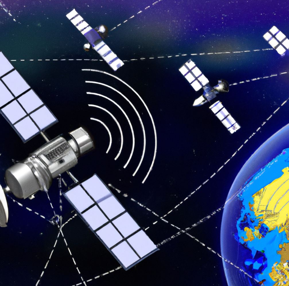
GPS is a satellite-based navigation system that works by receiving radio signals from multiple GPS satellites and triangulating the signals to calculate a user's exact location on Earth. By tracking signals from the satellites, GPS is able to accurately measure the distance from one point to another. It can even calculate when you will get from one "point A" to another "point B", allowing users to plan their trips accordingly. In addition, GPS also has the ability to measure boundaries and landmarks, detect changes in altitude, track motion, and perform a number of other functions.
So, how exactly does GPS measure time and distance? We'll break it down in this blog post, unlocking the mysteries of GPS in the process and shedding light on the amazing capabilities of this precise technology.
Quick Insight
Global Positioning System (GPS) uses radio waves and satellite technology to calculate the time difference between Satellites, which it then converts into an approximation of distance. It can also be used to measure speed by determining the amount of distance traveled in a given amount of time.
Understanding GPS Technology
GPS technology is a powerful tool for measuring time and distance. GPS stands for Global Positioning System, and it is a network of satellites that can track objects on Earth with extreme accuracy. Working together, these satellites are able to triangulate the exact position of an object in three-dimensional space. By utilizing this sophisticated system, GPS receivers have been able to measure distances with pin-point accuracy and offer users up-to-date information about location, time, and speed.
The overall effectiveness of GPS technology depends largely on the amount of satellites orbiting the earth. According to satellite tracking experts, there are now over 30 active satellites operating in various orbits across the globe. The sheer number of satellites ensures that even remote areas are still covered by at least one. This vast coverage has made GPS applicable for a wide range of civilian and military tasks including navigation, surveying, geospatial mapping, asset tracking and more.
However, despite its impressive capabilities some argue that GPS technology is not foolproof. Since it depends heavily on satellite networks, any signal disruption or loss could potentially halt the process and cause inaccurate readings. Inclement weather has also been known to disrupt the accuracy of readings taken from GPS devices due to signal interruption and distortion. To mitigate this risk many businesses employ GPS signal repeaters which help provide additional support in remote areas where radio interference is more likely.
These drawbacks aside, GPS technology continues to be a reliable way to measure time and distance around the world. As advancements in satellite and tracking technologies continue to expand its capabilities we will no doubt see an ever increasing array of GPS services emerge in years to come. Understanding how these services work begins with understanding how GPS satellites operate and interact with each other across the globe - the subject of our next section.
How GPS Satellites Really Work
GPS satellites are a critical part of how GPS works, as their location and transmission abilities enable it to make precise measurements of location. A GPS satellite orbits the Earth at an altitude of about 12,550 miles, or 20,200 km, and travels at speeds of around 7,000 mph or 11,200 km/hr. By dividing the circumference of the earth by the time it takes for a satellite to orbit Earth (about 2 hours), one can estimate that a single satellite circles the globe about 15 times per day.
Each GPS satellite constantly transmits information about its position and exact time to a receiving device on Earth. This includes data from its atomic clock, which is incredibly accurate and is used to measure location. Data from multiple satellites are picked up by GPS receivers, where they are then analyzed to calculate the device’s current location using a process called trilateration.
For this system to work, it is vital that the satellites maintain exact positions in space relative to each other and that their signals reach receivers without interference. To do this, the US government is required to maintain the GPS constellation—which consists of 24 to 31 navigational satellites—at all times. As such, some will argue that reliance upon such traditional technology can be unreliable if not maintained adequately while others will counter that governmental regulation ensures constant accuracy and reliability.
With now a better understanding of how GPS satellites work, it is also important to understand how these satellites communicate with devices on Earth. This will be discussed in the next section.
- The positional location of a satellite can be measured to within a few millimeters using GPS.
- GPS satellites broadcast a precise timing signal which allows the receiver to calculate its own position in relation to the satellites position with accuracy down to one meter or better.
- A single GPS receiver can measure distances up to 10 kilometers (6 miles) with an accuracy of 0.3 meters (1 foot).
How do GPS Satellites Communicate?
GPS satellites use radio waves to communicate with devices on the ground, transmitting information about their precise position in space. They communicate with each other too, bouncing signals back and forth in order to make an accurate calculation of the user's position. This communication is made possible due to two key elements: precise timing and satellite triangulation.
To calculate a GPS receiver's precise location, several satellites must send out an intersection signal at the same moment in time. This requires extraordinary accuracy and co-operation between all satellites involved, something which only occurs when they are networked together. Furthermore, these atomic clocks must run on the same exact frequency so that delays caused by signal transmission errors on Earth can be eliminated.
Furthermore, GPS relies on triangulation since it takes multiple satellite signals to receive a position. In effect, GPS receivers must detect three or more separate signals from different satellites above the Earth's horizon in order to provide a precise location fix. The calculations are based on the time it took for each of these satellite signals to reach the device, giving an incredibly accurate estimate of the user’s position down to within a few centimeters.
The controversy that exists within this conversation lies in whether or not this technology should be available to everyone and why. On one side of the argument, GPS technology has shifted from an expensive necessity only accessible by governments and private companies into something relatively cheap and easy to use even by individual consumers. Advocates argue that GPS technology is available largely because it enables us to live better lives and makes everyday activities easier and safer in times of emergency or distress. Conversely, some argue that there should be certain regulations regarding privacy and security issues related to GPS data as such data could be abused without proper protection.
No matter which side one agrees with, GPS satellites will continue to be essential in our day-to-day lives using radio waves to communicate their information effectively between themselves and with ground-level devices. Moving forward, we will explore how these satellites communicate information about users' positions in order to calculate speed and time via complex computational algorithms.
Calculating Position, Speed and Time
Calculating Position, Speed and Time is essential to measure distances on the earth with reasonable accuracy. It is through complex mathematical formulas and calculations that the Global Positioning System (GPS) finds its way in our lives. The Global Positioning System uses three basic measurements - position, speed and time - to calculate exact distances and locations.
Position is calculated using satellites that broadcast signals to receivers. By comparing data from at least three satellites, a receiver can precisely determine one's exact location anywhere on earth. This extremely precise calculation of an individual's exact geographic location has become very practical in recent years thanks to GPS technology.
Speed is a second factor used by GPS in measuring distance. Usually measured in a unit called knots, which are equated to one nautical mile per hour, speed allows for more accurate distance calculations over time. Furthermore, since speed is measured over a period of time it helps to make the distance measurement more reliable and dependable by eliminating variation of speed or rate of travel between two points.
Finally, time plays an important role in GPS calculations. In order for GPS technology to be able to make precise measurements, the satellites need to maintain an exact and synchronized time frame with the ground receiver stations. The timing of these signals must be correct within a small fraction of a second for the measurements to be accurate.
By relying upon these three elements - position, speed and time - global positioning systems are able to accurately measure distances across great lengths with remarkable precision. These techniques have revolutionized how people calculate short-term and long-term distances around the world. But how does this technology actually function during real-life scenarios? That’s what will be addressed next in the following section about “How Does GPS Make Time and Distance Measurements?”
Essential Points
GPS is a technology that uses 3 basic measurements: position, speed, and time to calculate exact distances and locations with remarkable precision. Position is calculated by comparing data from at least three satellites, speed is measured over a period of time, and accurate timing of signals from the satellites are required for precise measurements. These techniques have revolutionized how people around the world measure short-term and long-term distances.
How Does GPS Make Time and Distance Measurements?
One of the primary uses of GPS technology is measuring time and distance. By leveraging the signals sent out by Global Positioning System satellites, as well as factoring in the time lapse of each signal, GPS enables us to accurately measure both time and distance. By pinpointing exact coordinates within a three-dimensional space – longitude, latitude, and altitude – GPS allows for increasingly precise measurements.
Additionally, travelers utilizing a Global Navigation Satellite System (GNSS) receiver, such as those found on many mobile devices and in multi-function navigational systems, can receive timing signals from multiple satellites located thousands of miles away. This means that very small delays in the transmission or reception of timing signals can be identified and measured down to nanoseconds or even picoseconds. Doing so grants engineers unprecedented accuracy when measuring distances between two points or objects.
Undeniably, GPS navigation systems and GNSS receivers provide us with much greater efficiency and accuracy than ever before when it comes to attaining measurement results. However, some might argue that while GPS data may be reliable in most cases, there are still too many environmental variables that could affect any given measurement. For example, subtle changes in terrain topography could skew the tracks taken by GNSS receivers since the Earth’s surface is never completely uniform or parallel.
Ultimately, advances in GPS technology have given us powerful tools for making accurate time and distance measurements more efficiently than ever before. Despite its limitations due to environmental factors such as terrain topography, there’s no denying that scientific applications for this technology continue to expand as we learn more about how it works. With that in mind, let’s take a closer look at how GPS makes measuring time possible in the next section.
Measuring Time
Measuring time has been a long-standing challenge for people since ancient times. This journey began with tools and techniques designed to approximate the course of the sun, moon, and stars in the sky. Through these observations, people developed sundials, hourglasses, and water clocks to measure small units or intervals of passing time.
With the advent of satellite technology in the mid-20th century, accurate measurement of time became possible regardless of geographical location. The use of atomic clocks aboard GPS satellites has enabled us to maintain such a level of accuracy today. The orbiting satellites help us keep track of universal time by generating precise signals as they orbit Earth.
The importance of measuring time cannot be understated when it comes to applying concepts from physics, such as velocity and momentum. In order to accurately measure speed, one must also have a reliable means of recording the passage of time. It is essential that this level of precision exists if we wish to make more accurate calculations about motion in its many forms - the velocity of projectiles, for example.
Modern physicists are still exploring further possibilities for measuring and quantifying time beyond what current technology offers today. Proponents argue that it can be manipulated and controlled through theories such as relativity and quantum mechanics. However, detractors maintain that such concepts remain speculative thanks largely to their complexity and lack of experimental evidence or data.
Whatever the arguments may be concerning these theoretical models, GPS continues to serve us faithfully by providing us with a reliable method for collecting temporal data in even the most remote parts of our planet. With its ability to measure both distance and time simultaneously, GPS allows us to explore a whole new realm of understanding when it comes to physical phenomena in our world.
Measuring distance is essential for unlocking a deeper understanding when it comes to all types of motion - from legged locomotion in animals and airplanes alike all the way up to subatomic particles moving at near light speeds - so let’s take an in-depth look at how GPS makes measurement possible with its ability to find exact locations on Earth's surface.
Measuring Distance
Measuring distance using a Global Positioning System (GPS) is a simple and accurate way of doing so. Distance is calculated through the use of satellite signals. When a user receives three or more signals from satellites, the GPS device can accurately calculate its position as well as the distances between multiple points. The accuracy of this method is affected by many factors such as elevation, atmospheric conditions, obstructions, and geometry.
Techniques like trilateration and triangulation are able to provide a much more accurate two-dimensional (2D) solution than one-dimensional (1D) solutions. Trilateration uses three data points to calculate the distance between two points on the ground, while triangulation uses four data points to measure the same [1]. This allows greater accuracy in measurement of both short and long distances, with the results being achievable to within a few centimeters.
Additionally, GPS measurements can be improved with the addition of ground stations which collect multiple satellite signals for corrected location information and time synchronization on a regional or local level, making chip-level receivers significantly more accurate at positioning than what is achievable through only satellite signals alone.
These methods have opened up new possibilities for accurately measuring distance in a variety of applications such as surveyors, navigation systems, tracking systems, robotics development, transportation systems and environmental studies. With these advancements, it has become possible to measure entities such as speed and acceleration along with distance in real time and with fantastic accuracy.
Thus, when it comes to calculating and measuring distances between multiple points in an efficient manner with high accuracy, GPS enabled technologies are changing the game. By having access to precise distance measurements taken right from our smartphones or satellites everywhere in the world—over land or sea—we can easily unlock the mysteries of time and distance.
Moving forward into improving accuracy we now turn towards ground stations where multiple satellite signals are collected for corrected location information and time synchronization on a regional or local level. Next we will look at how improvements in accuracy through ground stations can affect navigating any location anywhere around the globe for our next section about: "Improving Accuracy with Ground Stations".
Improving Accuracy with Ground Stations
Accuracy of GPS measurements can be further improved with the help of ground stations. These stations act as reference points, allowing GPS receivers to ascertain accurate locations from a known base point. Instead of relying solely on satellite signals, ground station transmitters can be used to triangulate and calculate data about a user's location more accurately than ever before. Additionally, ground stations provide continuous feedback on errors that occur over time due to lens curvature, atmospheric disturbances and other variables, then correct them accordingly.
Ground station technology certainly adds an extra layer of accuracy to GPS measurements, but it is also accompanied by added costs and slower speeds. GPS measurements integrated with ground stations are much more expensive than those which don't use them, which deters some businesses and individuals from using this technology. Additionally, the increased number of calculations and additional transmission steps slow down the speed at which responses are sent back to users. There is a lot of debate surrounding whether or not the added cost and decreased speed associated with ground station technology outweighs its benefits in terms of precision accuracy.
The addition of ground station technology to GPS measurement systems provides important insights into the accuracy levels achieved and offers advanced capabilities for precise navigation. However, the more complex technical design comes with a tradeoff -cost versus speed. Moving forward, it will be essential for individuals and businesses alike to consider these factors when exploring their options for accurate GPS measurements.
A further factor to consider in improving accuracy with ground stations is redundancy - that is having multiple different types of signal sources such as radio waves and carrier phase measurements from both satellites and ground stations being redundant if one source fails. This ensures fault-tolerance in terms of providing consistent accuracy across different environments. For those who require high levels of accuracy in GPS applications, this redundancy feature serves as an additional safeguard against error or unexpected issues that may arise while performing mission critical tasks.
Given all these considerations, improving accuracy with ground stations is possible but complex, requiring careful deliberation on the tradeoffs between cost and speed when selecting appropriate equipment for receiving data. In the next section we explore common uses of GPS measurements beyond navigation that rely heavily on precision accuracy - making calculating errors even more critical in fast-paced applications such as drone delivery in urban areas or autonomous vehicles being developed around the world today.
Common Uses of GPS Measurements
GPS measurements are incredibly versatile and have a variety of uses in nearly every facet of life. In terms of navigation, GPS measurement is most commonly used to build location-aware applications, measure straight-line distances between two points on the globe, determine directions and guide travelers to their destination. For example, GPS technology can be accessed by mobile apps like Google Maps or Waze, allowing people to receive accurate directions and avoid traffic delays while driving.
In addition to aiding navigation, GPS measurements are also used frequently in the surveying process for construction sites or land plotting. Geographic coordinates obtained from a GPS receiver provide accurate locations for detailed maps which offer an immense amount of information about an area. These data sets can be combined with aerial photography to create 3D visualizations of surface features as well as underground infrastructure like gas lines or electrical cables.
Accurate location data such as this is also essential for providing reliable emergency response services to citizens. An ambulance driver may rely on GPS coordinates to quickly reach their destination and EMS teams can verify that they are at the correct address with little effort. Furthermore, many public safety organizations deploy specialized drones that are equipped with advanced positioning systems to assist in difficult search and rescue operations.
Despite these widespread positive applications of GPS measurements, there is still some debate as to how much access public institutions should have over user’s private location data. Understandably, some individuals have privacy concerns if their movements become tracked and analyzed by foreign entities. It is important for nations around the globe to ensure that conflict doesn’t arise between technology developers providing innovative solutions using satellite mapping and consumers who demand secure personal data management laws.
Common Questions and Answers
How has GPS helped increase accuracy in managing time and distance?
GPS has helped increase accuracy in managing time and distance by providing an extremely precise and reliable way to measure both. Digital satellites are able to accurately detect the precise location of a receiver anywhere on the planet, proving a highly accurate geographical positioning system (GPS). With GPS, it’s possible to pinpoint exact locations, along with precise times and distances between them. This helps users plan their routes, saving considerable time and energy in doing so. In addition to this, GPS assists people in navigating difficult terrains or unfamiliar places with ease. In the business world, GPS helps companies track vehicles or shipments more accurately than ever before, further helping to improve productivity and customer satisfaction levels.
How is GPS able to determine the exact coordinates of a location?
GPS is able to determine the exact coordinates of a location using a combination of satellite technology and triangulation. Satellite technology is the main means of information behind GPS; GPS receivers detect signals from satellites in Earth's orbit, which measure exact time and various other factors like location of the receiver itself. By measuring the distance from at least three or four satellite signals at the same time, a device can triangulate its location by calculating the differences in position compared to each signal. These calculations use algorithms to pinpoint an exact coordinate for the device's location.
What types of calculations are involved in GPS navigation?
GPS navigation involves a range of calculations to determine an accurate and precise location. The most fundamental calculation is the trilateration method, which uses Satellite Positioning System (SPS) signals sent from at least four GPS satellites to determine the exact position of a receiver. This process requires calculating the time difference between when the signal was sent and when it is received, in order to calculate the distance from each satellite. Other related calculations are time-of-arrival(TOA), angle-of-arrival (AOA), and signal strength applications used for determining location. Additionally, factors such as signal attenuation due to atmospheric conditions need to be taken into account for an accurate measuring tool. All of these various calculations combine in producing an effective result of location identification.
References
[1] Niculescu, Dragos, and Badri Nath. "Ad hoc positioning system (APS)." GLOBECOM'01. IEEE global telecommunications conference (Cat. No. 01CH37270). Vol. 5. IEEE, 2001.